Introduction
How do I begin to talk about The Silk Road, The Five Continents and The Seven Seas? Let me take a step back for the moment and lay the background for this story.
“Oh, East is East, and West is West, and never the Twain shall meet “. Many of us misattributed Rudyard Kipling to racism by quoting this first line in the poem “The Ballad of East and West”. Those who know and cite the poem’s first line have never read the third and fourth lines, which counter the opening line. The whole refrain that opens and closes the verse reads:
“Oh, East is East, and West is West, and never the twain shall meet,
Till Earth and Sky stand presently at God’s great Judgment Seat.
But there is neither East nor West, Border, nor Breed, nor Birth,
When two strong men stand face to face, though they come from the ends of the Earth.”
“twain” means “two.” Indeed, the culture of the West will always be different from that of the East (Asians). However, “Twain” reminded me of Mark Twain, which has Nothing to do with the “twain” of Rudyard Kipling. Mark Twain, of course, was the nom de plume (pen name) of Samuel Langhorne Clemens (1835 -1910). Clemens was an American writer, publisher, and lecturer. He claimed he had appropriated his by-then-famous nom de plume from a staid Mississippi riverboat captain. Samuel Clemens loved the paddlewheel steamboat and loved the river. He learned how to sail on the Mississippi.

The Leadsman
For the ship captain, it was essential to know how deep the water was as there was the risk of running aground if the water was too shallow. The leadsman used a lead line to determine water depth and the kind of stuff (mud, sand, or potentially hazardous rock) at the riverbed or bottom. He tied a piece of lead to one end of a hemp rope and made a mark on the rope at every fathom (6 feet). The leadsman would throw the lead line overboard. As the line sank to the bottom, he would start counting the marks. By multiplying the number of marks, he could figure out how deep the water was at that spot. If he counted two (2) marks, for example, that meant the depth of the water equalled two fathoms (12 feet). The leadsman was the person who “heaves the lead” and “sings the mark”. In the “Old days”, the marks were called out or chanted as the steamboat made its way along the river. “mark twain” was a frequent call from the leadsman during Samuel Clemens’ years on the river. The call meant that the water was two fathoms (12 feet) deep and indicated safe water.
“Mark Twain”
Twain’s biographer, Albert Paine, recounted a shoal crossing on a trip in early July 1886. As the water grew shallower, the measurement came closer to the famous pseudonym of the vessel’s distinguished passenger. The leadsman began to chant out the depth. The cry “mark twain “reverberated through the fog of a gloomy day. Mark Twain, no doubt still deep in thoughts of his boyhood when his young daughter Clara emerged from the shadows and called out to him reprovingly: “Papa, I have hunted all over the boat for you. Don’t you know they are calling for you?”
No matter. Samuel Langhorne Clemens had become widely known in Virginia City when the pseudonym Mark Twain first appeared in the newspaper Enterprise on February 3, 1863. Clemens claimed he had appropriated his by-then-famous nom de plume from a no-nonsense Mississippi riverboat captain. However, according to another source, Clemens acquired the nickname from his habit of striding into the Old Corner Saloon in Virginia City and calling the bartender to “mark twain!”. In Virginia City, “mark twain” meant bringing two blasts of whisky to Sam Clemens and making two (2) chalk marks against his account. The bartenders in those days kept the “tabs” at the back wall of the saloon. It reminded me of how the tabs of my orders for drinks in a small hotel at Obertauern were “posted” when I skied there in 1983 …
Travel makes us
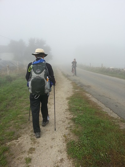
I have enjoyed the writings of Mark Twain. Not so much the Adventures of Huckleberry Finn (1884) but his part memoir, part fiction book Life on the Mississippi (1883). Many lauded Mark Twain as the greatest humourist the United States has produced and one of America’s most famous writers. Yes, I can relate to his life in the Mississippi. Even though perhaps not like how the Mississippi River had made Mark Twain, sailing the world has made me! Travelling the world, especially over the last twenty years, has prompted me to reflect more than ever before. I began to discover myself and understand “who am I?”… My journey has also encouraged me to ponder the change and progress in this fast-moving world. Culturally and technologically, I have tried to observe with interest and enthusiasm. I do love travelling as a learning experience. Perhaps it is true that “Only two things we’ll regret on deathbed – that we are little loved, and little travelled”!


The Silk Road
The German geographer Baron Ferdinand Freiherr von Richthofen (1833-1905) coined the term “Seidenstraße” – Silk Road – referring to the 6,437 kilometres trade route connecting China and the Mediterranean in Ancient times. He has imbued this immense terra incognita of East Asia with romance and myth ever since. However, even though craved by Europeans, silk was just one of the treasured commodities transported along the route. Intrepid merchants and traders with caravans carried spices, ivory, gems, garments, works of art, exotic animals and much else across this vast land.


Discovery of Silk
But, since silk “created” the Silk Road, let us learn a little about silk. Silk production originated during the Chinese Yangshao Culture (discovered in 1921 in Henan Province). Legends and myths surround the origin of silk. Confucius and other Chinese Traditions recounted that in around 3000 BC. a silkworm’s cocoon fell into the teacup of the Empress Leizu. One of the Empress’s servants tried to extract it from her drink. The Empress saw the fibres that constituted the cocoon, decided to weave some of it. On the recommendation of her husband (the Yellow Emperor), she kept some cocoons and then taught her entourage the art of raising silkworms. This was the beginning of sericulture. The use of silk was not confined only to clothing. The Chinese used silk also for other applications such as writing. The colours of silk clothing worn also held social importance. It formed an essential guide to social class during the Tang Dynasty.
Silk outside China
The technique of silk production remained confined to China until the Silk Road opened in (114 BC?). Even then, China maintained a virtual monopoly of its production for another thousand years. Knowledge of silk production eventually left China. The silk material first reached Persia and onward to the Mediterranean countries. Before his death, because of the volcanic eruption of Vesuvius (79 AD), Pliny the Elder notably and accurately described silk and from where it came. Speaking of Bombyx (silk moth), he wrote in his Natural History, “They weave webs, like spiders, who become a luxurious clothing material for women, called silk.”
A portion of coloured silk fabric was found at Qustul, south of Abu Simbel, whose exact date is unclear. From the fourth century onwards, silk became more common in Egypt. Archaeologists examining hair samples of mummies in the scanning electron microscope found a piece of tissue between the curls with the characteristic appearance of silk. To show that the specimen was silk, they performed infrared studies using multiple internal reflections, allowing non-destructive identification of the material. The spectra identified silk: – Use of Silk in Ancient Egypt by G. Lubec, J. Holaubek, C. Feldl, B. Lubec, E. Strouhal (Original print at NATURE March 4, 1993).
Some remnants of (Chinese?) silk dating from 1070 BCE had been found in Ancient Egypt. If it was cultivated silk, then it undoubtedly came from China. However, scientists recently uncovered that some Egyptian mummies were buried with silk despite the Silk Road not being firmly established at that time. The exact date silk first appeared in the West from China, India, and Persia is still being debated. Did the Romans bring silk there? Did Mark Anthony give Cleopatra silk as a present when they met at the Cleopatra Gate in Tarsus? The earliest example was traced to the Ptolemaic Period of Queen Cleopatra… Lucan described queen Cleopatra with “her white breasts resplendent through the Sidonian fabric, which, wrought in close texture by the skill of the Series, the needle of the workmen of the Nile has separated and has loosened the wrap by stretching out the web“: – Ancient Egyptian Materials and Industries (Fibre: woven fabrics and dyeing p.149) by A. Lucas, J. Harris.

The Oasis Towns

The Oasis towns of Central Asia played a critical role in the effective functioning of the Silk Road trade. In modern times, in the gardens of these towns, I still see date palms with slender trunks or stems and at their tops are leaves of five to ten feet in length forming majestic crowns. In some regions in the Levant and Cyprus (where I have spent considerable time), I have noticed that some of the date palms do not attain the size as those in Egypt nor do they bear fruits, except standing as noble ornaments besides the pomegranate and orange trees. However, some do grow to considerable and immense heights; as high as the rubber trees in Sabah where I grew up.
Changan (Xian)


At one end of the 6500 km Silk Road was the Chinese capital of Changan (modern-day Xian with a history of over six thousand years). Changan was one of the birthplaces of the Chinese nation and eastern civilisazon. At the other, Palmyra and Rome. Unlike Rome, most people do not know Palmyra (which ISIS sought to destroy in 2015). The town, founded third millennium BC, was a caravan centre of multiculturalism, linking the great land and trading corridors from China to Rome. It lies in the middle of Syria about halfway to the East, between Damascus and Antioch (modern-day Antakya) in the South of Turkey. “One thing however is certain. If silk crossed the northern deserts of Greater Syria, it was forced by geography and climate through the ancient emporium of Tadmor, renamed “Palmyra” by the Roman annexation”: – Finlayson, Cynthia, “The Women of Palmyra–Textile Workshops and the Influence of the Silk Trade in Syria” (2002). Textile Society of America Symposium Proceedings.
Palmyra.


Archaeologists discovered pearls from the Gulf, Han Chinese silk textile fragments in the tombs in Palmyra. The physical evidence of silk at Palmyra was primarily from remnants utilised as funerary offerings and mummy wrappings for the bodies of wealthy citizens interred in tower tombs of Palmyra. Go-betweens carried these items from China to the northwest Indian ports and onwards to Palmyra, which highlighted the involvement of Palmyra in the heydays of the Silk Road. Palmyra was the only viable source for pastures, water, and salt for large expeditions by caravans as they ventured across the Syrian desert to the Mediterranean port of Antioch and Tyre. Here, traders could also pick up such desirable as ivory and beads made of agate, carnelian, cotton, spices, and medicinal plants. But silk was the most prized of all the exotic goods the enterprising merchants transported along the Silk Road, from the East to the ports in the Levant. Palmyra, together with Rome, manifested the cross current of cultural exchange of East and West in every aspect of life.
Travels on the Silk Road
I always had a fanciful vision and dream of taking a journey along the Silk Road. However, travelling the Silk Road across this landscape of Central Asia is not easy. There is a lack of adequate safety and security besides the adverse weather conditions and rugged terrain. The geographic features made it difficult for travellers to travel along the Silk Road even in modern times.


The Road from China to the West passes through desert stretches, including the Gobi and Taklimakan, with brutal winds and swirling sandstorms. That was why we chose train travel instead to cross over some part of this enormous region in the Spring of 2016. So, on July 15, 2016, at 11:30 pm, we found ourselves at the Yaroslavsky station in Moscow, soon to embark on this journey into the “unknown”.
The Russian
When we boarded the train, we discovered a Russian man in the next cabin. I instantly thought: “The Russians Are Coming, the Russians Are Coming. “…This was a comedy movie about a Soviet submarine getting stuck on a New England Island coast sandbar. Its commander Theodore Bikel orders his second-in-command, Lieutenant Rozanov, to move it before an international incident. They claimed they were Norwegian sailors to take the edge off the islanders’ fear of a Communist invasion. Despite that comedy movie, there have been so many negatives in Western Press about the Russians. It is not my intention nor the purpose of this story to get into geopolitics.


The Russian man in the cabin next to us (whom we eventually found out) was Alexander, an influential economist. He was compelling enough to make advance phone calls to his contacts to bring him food and medicine at various train stops along the way. Alex, a remarkable man (with tremendous generosity) who did not speak much English, would show us photos of his family and friends on his laptop computer. Intermittently, he would share with us the provisions brought onto the trains for him by his contacts. Because of Alex, we had the opportunity to enjoy Russian “pizza” and fruits among other Russian home-style meals and savoury… Events happen, and people come into our lives for a purpose. Events happen so that we may learn or draw experience from them for the common good. More on this story can be found in “Journey to Siberia and Beyond” in the publication Free Pilgrim 2.
Let us get back to the story on the Silk Road.
The Origin of the Silk Road
How did the Silk Road originate? It lies in the politics of ancient China. According to the old Chinese source, the Xiongnu, a tribal confederation of nomadic tribes, inhabited the eastern Eurasian Steppe from the third century BC to the late first century AD. They became a dominant power on the flat unforested grassland of East Asia, centred on an area later known as Mongolia. The Han Chinese battled with them (known as the Sino-Xiongnu War) from 133 BC to 89 AD. The Han emperors also tried to appease them with silk, wine, and grain tributes. The Xiongnu, in turn, then began trading some of their newly acquired Chinese goods with others, extending farther and farther west. These trades along the way to the West stirred what we now know is the beginning of the Silk Road.


“Silk People”
By 60 BC the Han Dynasty defeated the Xiongnu and was now in absolute control of the Western Regions. The Chinese expanded its influence on the West and inaugurated an official trade policy along the Silk Road. They established embassies, sending missions westward, bearing silk, other goods, and luxuries, to court other tribes. The Romans were intrigued by the East’s mysterious “Silk People” and soon became obsessed with silk. The Chinese, on their part, readily sought Western glassware and silver, Roman metalworking, Parthian clothing, Byzantine coins, and Persian textiles. All these had a tremendous influence on the art of the Tang period- 618 to 907 AD (with an interregnum between 690 and 705). The Tang Chinese tastes for foreign luxuries were more vital than ever, and foreign artistic traditions were absorbed into domestic ones, resulting in successful cultural assimilation.


The Effects of Silk Road
The Silk Road led to a mingling of cultures, arts, and technologies between East and West. Trade is what it is today because of the exchange undertaken, which had happened on an unprecedented scale. This “highway” also carried knowledge: ideas about cosmology, engineering, gunpowder, medicine, and printing. However, aside from material goods, the Silk Road’s most significant legacy is exchanging ideas and religious beliefs along its caravan routes. Along the road, monks travelled side-by-side with merchants and traders, instructing those they met in the secrets of Buddhism, Judaism, Christianity, Islam, Taoism, Confucianism, Manichaeism, and others.
Those early cultural ambassadors stopped at the oasis towns on the Silk Road – bearing scriptures and winning converts! China first received Buddhism (from India) and Nestorian Christianity before Islam. Nestorian missionaries were firmly established in China during the early part of the Tang dynasty. The source known as the Nestorian Stele records a mission under a Persian proselyte named Alopen as introducing Nestorian Christianity to China in 635 AD. The missionaries established worship places and propagated their faith… Monasteries, stupas, and Buddhist caves started to form and became part of the Chinese landscape. However, religion has had (and still has) a challenging history in the country.


The Venetian
Marco Polo (1254 –1324), a Venetian merchant, explorer, and writer, embarked on an epic journey to Asia with his father and uncle. They explored many places along the Silk Road until they reached Cathay (China). He further travelled through Asia along the Silk Road between 1271 and 1295 and recorded all his travels. His book The Travels of Marco Polo described the culture and inner workings of the East to the Europeans. It mentioned the size and wealth of the Mongol Empire and China, giving the Europeans their first comprehensive look into China, Persia, India, and other Asian countries. Impressed by Marco’s intelligence and humility, the Mongol emperor Kublai Khan (grandson of Genghis Khan) appointed him as a foreign emissary. After that, he travelled across vast areas conducting diplomatic missions for Kublai.
Marco Polo gave an accurate account of the Mongol system of administration and its rule. He accurately described Chinese social norms and practices at the time and correctly recounted the prosperity and advanced technology of China and its many cities. He also gave a good description of Hindu customs in India and the spices of South-East Asia. Archaeologists have proven that his observations were correct. Marco Polo had observed that there were many Nestorian Churches in Central China. The remnants of these have been found in recent decades. Many of his descriptions of China and East Asia’s geography were accurate, and so too is his description of the Northern Silk Road.


The Demise of the Silk Road
Historians have been debating on the reasons and causes of the decline of the Silk Road. This story is based purely on my humble opinion formed through my journey, peregrinating, research and study. Readers of this blog may have their views which I respect, not reject. If I want only to hear others say the same thing as what I think, then I learn Nothing because I already know. We can have the blessing of sharing each other’s views, thereby mutually widening our horizons. I cherish the chance to share stories from diverse cultures worldwide with the hope of countering bigotry and achieving peace despite our differences. We all together can learn a little more about and understand who we are as a human collective (particularly about ourselves), even when separated by continents and millennia. We can let our humanity shine through our works, and shared appreciation for beauty, reason, and the cultures of the world we live in and around us.
Factors involved in the Demise
To me, the final demise of the Silk Road was due to several factors. Trades and businesses along the Silk Road were affected when the Mongols, led by Genghis Khan, captured much of Asia and laid waste oasis towns to the Caspian Sea. Upon his death, one of his grandsons, Batu Khan (of The Golden Hord), changed the trade routes linking to the Silk Road. The Silk Road declined further when the great empires of China (Tang Dynasty), Persia and Byzantine experienced turmoil, which ran concurrently with or followed by the Crisis of the late Middle Ages. The Black Death pandemic ravaged Europe between 1347 and 1351, which took a significant toll on human life, more than any other known epidemic or war up to that time. There were also recurrences of plagues in 1361-1363, 1369- 1371, 1374-1375, 1390 and 1340. Recent research has suggested that plagues were brought into Europe multiple times over this period, coming in waves from Central Asia along the Trade Routes. Then there was the Hundred Years’ War fought between England and France (1337-1453) over territorial rights and the issue of succession to the French throne.


The Fall of Constantinople. On May 29, 1453, the Ottoman Anatolia Beyliks, under Sultan Mehmed II conquered Constantinople (modern-day Istanbul). The conquest of Constantinople transformed the Ottoman into a transcontinental force, thereby ending the Byzantine Empire. The Ottoman Empire entered further into a period of expansion. It flourished economically due to its control of major overland trade routes and prospered under the rule of a line of effective Sultans.
Competitions from Shipping


Merchants and traders noticed that sea routes were safer, and without the intermediaries, transport by sea replaced the overland trade routes. Consequently, many oasis towns were lost, abandoned, and submerged in the shifting sand in real life and in the sand of time. Middle Ages was undoubtedly a period of volatility, complexity, ambiguity, and uncertainty. Not necessarily in that order. In general, the industry, market, and the world changed faster than people had expected. The Silk Road had brought varieties. The greater the variety, the more complex the environment became. The situation became ambiguous because of different customs, cultures, and languages. Information was incomplete, inaccurate, or contradicting. Was the future uncertain and hard to predict? The rift started between East and West. The Ming Dynasty then closed its door with its isolationist policy.

It is interesting for us to note that as sea-routes began to overshadow the Silk Road the railroad was starting to give competition to shipping by the time of Mark Twain. With steam propulsion developed and the technology adopted, railroads began to flourish. Even though early uses of railways gave a slight hint, a revolution in methods of transportation was already underway. Every reader of Mark Twain is aware of the competition railway had with shipping. Mark Twain noticed that despite the numerous packet ships that plied the waterways, shipping was vastly different from what it had been in its heyday before the American Civil War and the era of the railroads. Twain saw shipping as a declining medium of trade. Shortly after his steamboat journey from New Orleans to St Paul, he described the competition from railroads!
The Legacy
Today, a part of the Silk Road still exists on a paved highway connecting Pakistan and the Uygur Autonomous Region of Xinjiang, China. The Silk Road has been the impetus behind a United Nations plan for a trans-Asian road. The UN Economic and Social Commission has proposed a railway counterpart for Asia and the Pacific (UNESCAP). In recent times, the Silk Road inspired cellist Yo-Yo Ma to found the ”Silk Road Project”. This arts organisation initially focused on exploring the cultural traditions along the Silk Road. Soon after that, Ma established the Silk Road Ensemble and the group’s first recording, Silk Road Journeys: When Strangers Meet, was released in 2002. The project’s scope subsequently expanded, using the Silk Road as a metaphor for connecting artistic endeavours worldwide and across cultures.
Over the years, with research, we understand the Silk Road and its significance again as part of a remarkable thing that lasted more than 15 centuries: the beginning and the great flowering of multiculturalism. This multiculturalism opens us. It opens us up to welcoming in other cultures and hopefully opens people to greater freedom. Cultural social norms and traditions are both dynamic. By its very nature, culture is in continual change and transformation. Even though we stand on the shoulders of our ancestors, tradition grows, hopefully always with the exact nature. And even though technology seems to have the upper hand. The structure of our social networks influences whether we spontaneously adopt new social conventions. Large homogeneously mixing populations like what we have in North America are likely to spontaneously create social norms. A weak leader (or person) with no convictions will seek popularity. He/She will follow and evolve with the social norms. Consequently, ideas begin to evolve and we will be restricting/eliminating (instead of enhancing) life. We must respect the cultural origin of every person. However, “East is East, and West is West” and is not imposed or dictated by a single culture. There is no uniformity of culture. There is variety, but hopefully diversity in unity for the common good.
The Five Continents
What are the five continents

The Origin of Continents and Oceans?
The originator of the scientific theory of continental drift, Alfred Wegener, hypothesised that the continents once formed a contiguous landmass. He postulated that all the continents were from a single supercontinent which he called the “Urkontinent” before it broke up and drifted to its present locations. He further expanded this hypothesis in his 1915 book The Origin of Continents and Oceans (Die Entstehung der Kontinente und Ozeane). The name “Pangea” occurs in the 1920 edition of Die Entstehung der Kontinente und Ozeane. The name “Pangaea/Pangea” is derived from Ancient Greek pan (πᾶν, “all, entire, whole”) and Gaia (Γαῖα, “Mother Earth, land”).
Francis Bacon, in 1620 first noted the matching shapes of the coastlines of western Africa and eastern South America as maps of Africa and the New World first became available. Gondwana is the southern half of this super southern continent. Alexander Du Toit, a South African geologist, expanded the concept of Gondwana in his 1937 book Our Wandering Continents. Du Toit carefully documented the numerous geologic and paleontological lines of evidence that linked the southern continents. Interest in continental drift increased in the 1950s as people gained knowledge (of the Earth’s geomagnetic field) from the studies of the British geophysicists Stanley K. Run corn, Patrick M.S. Blackett, and others.
By the late 1960s, several American investigators, Jack E. Oliver, and Bryan L. Isacks had integrated the notion of the seafloor spreading with drifting continents and formulated plate tectonic theory. According to the latter hypothesis, the Earth’s surface comprises several large, rigid plates that float on the asthenosphere’s soft (partially molten) mantle layer. It seems though it is still unproven, that this breakup of a single landmass and the drifting of its fragments is merely the latest in a series of similar occurrences throughout geologic time. We will leave this theory and hypothesis for the experts and scientists to further explore…
The Five Inhabited Continents
The Olympic Rings, designed in 1912 by Pierre de Coubertin, the “father” of the modern Olympic Games, is a Symbol representing the five inhabited continents of the world. The continents are Africa, America, Asia, Europe, and Oceania/Australia.


The combined-America model
France, Greece, Italy, Latin America, Portugal, Romania, and Spain often use the combined-America model. : – Africa, America, Antarctica, Asia, Europe, and Australia/Oceania.


The combined-Eurasia model
Russia, Eastern Europe, and Japan primarily use the combined-Eurasia model. The six-continent combined-Eurasia model: – Africa, North America, South America, Antarctica, Eurasia, and Australia/Oceania.


The Seven Continents and Their countries
A continent, by definition, is a large continuous area of landmass. The South Pacific Islands of Oceania are strictly not a continent. Still, Oceania is sometimes associated with the continent of Australia. There is, by most standards, a maximum of seven continents – Africa, Antarctica, Asia, Australia/Oceania, Europe, North America, and South America.

Whether there are five, six or seven continents, there is so much for us to see and learn. The important thing is to “get away” from our “games,” or whatever and go on our journey, travel the world. We can do it physically or virtually and, in the process, learn more about ourselves. Most of us like our comfort zone, but we also know that Nothing ever grows in our beautiful comfort zone!
The Seven Seas
The origin of the phrase “Seven Seas”


People have been building boats and sailing since the Biblical time of Noah. In New Testament time, St. Thomas sailed to India. They built ships, and because of these sea voyages, they introduced agriculture, architecture, horticulture, mathematics, medicine, science, idea, philosophies, and religions.
The phrase “Seven Seas” has been referred to in various cultures at various times in human history. People in ancient Mesopotamia were the first to keep records of their observations. They saw the seven moving objects in the heavens (the seven classical planets) and made this connection to their seven seas. Their effects are still being felt today. In Greek literature (the root of all Western literature), the Seven Seas were the Adriatic, Aegean, Black, Caspian seas, Mediterranean, Persian Gulf and the Red Sea.
Bodies of water
“Seven Seas” were often referred to as bodies of water, regional bodies of water or exotic and far-away bodies of water along trade routes. There is the story of a fictional mariner Sindbad, the hero of a story cycle of Middle Eastern origin. By the ninth century, the Arab Nisba al-Yaqubi wrote about sailing to Khanfu (Guangzhou). He wrote about the seven seas: whoever wanted to go to China must cross seven seas, each with its colour, wind, fish, and breeze, completely unlike the sea beside it. To the Arabs, the seven seas were: Persian Gulf (“Sea of Fars”), Arabian Sea (“Sea of Larwi”), Bay of Bengal (“Sea of Harkand”), Strait of Malacca (“Sea of Kalah”), Singapore Strait (“Sea of Salahit”), Gulf of Thailand (“Sea of Kardanj” and finally, South China Sea (“Sea of Sanji”).


In British Colonial times, the “Tea Route” from China to England was the longest sea route in the world. When someone is said to have sailed the Seven Seas, it would mean he had sailed to the Far East, the other side of the world and back. It took sailors through seven seas near the Dutch East Indies. The Seven Seas in the “Tea Route” were the Banda Sea, Celebes Sea, Flores Sea, Java Sea, South China Sea, Sulu Sea, and the Timor Sea. After the Europeans “discovered” the Americas, the concept of the “Seven Seas” changed again. Nowadays, this phrase is not often used.
The Popular Seas
The Adriatic
In modern times, two of the most popular seas visited by international tourists are the Adriatic and the Aegean. The Adriatic Sea, considered the northernmost arm of the Mediterranean Sea, separates the Italian Peninsula from the Balkans. It contains more than 1,300 islands along the Adriatic’s eastern coast – especially in Croatia, with 1,246 counted. More than 3.5 million people populate the shores. The most prominent is Dubrovnik which UNESCO added to the list of World Heritage Sites in recognition of its outstanding medieval architecture and fortified old town. The Italian cities on the West of the Adriatic are Venice and Bari.


The Aegean
The Aegean Sea is situated between the Greek peninsula on the West and Asia Minor on the east. The Aegean is historically significant, especially concerning the civilisation of Ancient Greece. Many islands in the Aegean are extensions of the mountains on the mainland of Greece. One of the chains extends across the sea to Chios, and another extends over to Samos. The third extends across the Peloponnese and Crete to Rhode.
There are five (5) UNESCO World Heritage sites located in the Aegean Islands; these include the Monastery of Saint John and the Cave of the Apocalypse on Patmos, which we visited in late 1996, the day after we were on the Island of Rhodes. The Aegean islands within the Aegean Sea are significant tourist destinations that contribute a sizable portion of tourism in Greece. The islands of Santorini and Mykonos are top-rated typical tourist destinations, with an estimated two million tourists visiting Santorini annually. We will talk a bit about these two world-famous islands.


The Two Famous Islands of The World
Santorini
Santorini, the remnant of a volcanic caldera, is the largest island with the same name as the chain of islands in the Aegean Sea. It was the site of one of the significant volcanic eruptions which occurred about 3,600 years ago at the time of the Minoan civilisation. It is also sometimes called the Thera eruption. Discovery at the southern tip of the large town of ancient Akrotiri revealed multi-level buildings, streets, and squares with the remains of eight-metre high walls. All these were entombed in the solidified ash of the famous eruption of Thera. Some stone staircases are found still intact. Inside some houses, archaeologists have found substantial ceramic storage jars and pottery. Wall paintings or frescoes have kept their original colour. They were well preserved under many metres of volcanic ash.


Even if one has never been to this island, one could still recognise it immediately. The island is adorned famously by chalk-white buildings, candy-houses carved into cliffs, topped with cobalt-blue domes and surrounded by the crystal blue waters of the Southern Aegean Sea. It was praised as the world’s top island by many magazines, travel sites and news channels, including the BBC and US News.
An Encounter
While crossing the Atlantic, I once conversed at breakfast with a retired American scientist originally from New York. We were sailing from Fort Lauderdale to Barcelona on the Celebrity Silhouette. He had recently retired and moved to Sarasota in Florida. His wife was originally from Turkey, where they still maintained a second home. He brought up the subject of the Dead Sea Scrolls. He asked me whether I had ever seen the Scrolls. I admitted I had not. He told me that since its premiere exhibition at Discovery Times Square in New York in 2011, millions of people had seen the collection of the ancient writings. Most of them, he told me was in Hebrew and included fragments from every Old Testament book.
He asked me what countries I had visited. At that time, I had only been to seventy-four (74). He asked whether I had been to Israel and Greece. He had made a list of destinations he would like to visit, and Santorini was on the top of his list. As he sipped at his coffee, he looked surreptitiously towards the ocean. I could tell that in his mind, the white lines of houses, blue domes and the glittering blue Mediterranean Sea were as far from his former New York apartment as he could imagine. Nothing of him escaped me, but I didn’t want to show much I had noticed. I tried to draw him back on track. “Anyway,” I said. “Besides the white lines of houses, blue domes and glittering sea, Santorini has many other attractions”.


I am not a person of details in describing my travel. After reading my “Free Pilgrims” series of travel books, some readers complained about this. But, because I sensed this scientist’s curiosity, I thought that I would make this time an exception. I told him we had been to Santorini twice. And I elaborated. “Because of the number of visitors going to Santorini, we would bump into something quite unexpected,” I said. I told him that during one occasion in 2014, we had a newlywed couple going with us into the gondola and riding with us to the top.
In contrast, we watched in awe some other tourists struggling but enjoying themselves as they ascended the same hill on the backs of donkeys. He looked at me incredulously with his wide eyes and listened with an indulgent smile. Then he arched his eyebrows, “They provide donkeys for tourists?”. I nodded my head. He arched his eyebrows deeper. “Are you sure?”. Yes, some tourists do pay for the donkeys to ride them up the hill. And a person walking on the same path had to observe the ground as he walked on because the donkeys’ excretions were free.
By sheer coincidence, I would meet this American scientist on another cruise. He recognised me from a distance. He pointed his fore and middle fingers to his own eyes and then pointed with the same fingers at me. It was his way of saying and indicating that he saw and recognised me. We talked again, and he told me that he and the wife had not travelled lately because his ageing mother had fallen ill. I have come to realise that there is no other way of being certain whether you like or dislike a person other than to travel with them!


Mykonos
Some people nicknamed Mykonos “The Island of the Winds” because of the powerful winds that usually blow on the island. The island is mainly composed of granite, and the terrain is very rocky, with many areas eroded by the intense winds. The island is relatively tiny, 85.5 square kilometres and rises to an elevation of 341 metres at its highest point. Windmills that dotted the island, concentrated in the main town of Chora, are a defining feature of the Mykonian landscape. The famous “Kato Mili” windmills in Chora stand in a row on a hill overlooking the sea.
The Venetians built these windmills in the 16th century to mill flour. They were constructed in this location to harness the strong northern winds. They capped them with wood and straw, and they remained in use until the early 20th century. Over the years, many have been refurbished and restored. While Santorini and Mykonos are favourite destinations, millions of travellers have missed the sights of the Aegadian Islands (the islands of goats), a group of five small mountainous islands west of Italy. These tiny islands are situated in the Tyrrhenian Sea, which is part of the Mediterranean.


My Favourite Place
With my extensive travels and having read the “Free Pilgrim” series, some have asked me which place was my favourite of all the places I have visited. There are, of course, many that I have experienced. It is a question I have found most challenging to answer. But sometimes things happened, and the event occurred to help me remember a unique place – Erice, on the Island of Sicily, came to my mind. Why Erice? Erice, high above the natural harbour of Trapani, is in such a spectacular naturally fortified position that it is not surprising people have occupied it for millennia. Erice has a remarkable number of interesting old churches, which include the church of Chiesa di San Giuliano. It is also not surprising either that the shifting clouds and air of mystery have made this place a sacred site in its long history.


As for us, the most exciting way to get to Erice is by taking the cable car (funivia), which is just outside Porta Trapani, the gateway into the old town of Trapani. The ten-minute journey from there to Erice by the funivia was wonderfully panoramic, with views back over Trapani, the sea, and the Aegadian Islands. But then something happened. With so much excitement as I got off the gondola, I had forgotten my backpack. I had left it behind on the seat. By the time I realised it, the cable cars were already on the way down. I approached one of the cable car service personnel and told him my predicament. He ranged up the station below, and then they informed him that someone had sighted my backpack, and it would travel back to me…
So, I waited eagerly for its arrival. I would not like to mention what was in the bag. But I know, and you can imagine, the thought of those things had not escaped me. Things happen for a reason! It was an event that occurred so I will never forget Erice and write about it. Besides, I still remember walking along those medieval lanes. We also purchased and tried the famous pastries which the shopkeepers proudly stacked up in the windows of several Pasticceria!


As I sat on top of this mountain in the old walled town of Erice, looking out into the sea, I began to wonder why people had left their homes and voyaged all over the world? The journey took them outside their comfort zones and pushed them to their limits. Perhaps because they craved knowledge and new experiences, people in the past had travelled and sailed far into the unknown. They tapped into that craving and conquered new territories. They found the unfamiliar environment exciting. The thrill started the minute they landed in a new place and walked on foreign grounds. Some settled.
Reflection

Travels open the mind
At the beginning of this story, I admitted that I love travelling the world as a learning experience, but more for me. It has opened my mind and helped me realise that there is no one way to live life. At the same time, I know we cannot choose life, but we need to make choices to live it. Sailing the Seven Seas has exposed me to unfamiliar places, people, and cultures. Meeting and interacting with people of diverse cultures from other world areas, from Arica to Yokohama (not yet Zanzibar), Africa to America, has shown me that my worldview is not necessarily the same as everyone else’s.
Different settings I experienced have also helped me look for and consider fresh ideas that I had never thought of before. I feel blessed and am thankful. Because I am not just an armchair tourist watching all these on a television screen, reading them in a travel book or magazine but learning in real life, they would stay with me for a long time, and I can write about the experiences… in gratitude (do I sound old-fashioned?) … It is good to show appreciation and be thankful…


The Seafarers of the past

Zheng He (1371-1435) was considered the greatest explorer in China’s early Ming dynasty. He was born as Ma He in a Muslim family and later adopted the surname Zheng conferred by Yongle Emperor. Zheng commanded seven expeditionary voyages to Southeast Asia, the Indian Subcontinent, West Asia, and East Africa from 1405 to 1433. He established diplomatic relations with the rulers in Vietnam, Thailand, Malacca in Malaya (Malaysia), Java, Kozhikode (Malabar Coast of India) and Sri Lanka.
After stopping at some ports of Asia on his fourth voyage in 1413, he proceeded westward from India to Hormuz. The mission continued to Egypt. A detachment of his fleet sailed south to the coast of Arabia and visited places in Somalia and Kenya along the east coast of Africa, almost reaching the Mozambique Channel. On his return to China in 1415, he brought the envoys of more than 30 South and Southeast Asia states to pay homage to the Chinese Yongle emperor. During his fifth Voyage (1417-1419), he revisited the Persian Gulf and the northeastern part of Africa. In his sixth Voyage in 1421, the fleet took all foreign emissaries from China home.


The encounters of Zheng He?
What has fascinated me was that if Zheng had sailed to the Northern part of Africa, he would have been to Egypt, a well-known country in the days of the Silk Road. Would he have learned of the early civilisation of Ancient Egypt and the Karnak Temple? The thought of the Karnak Temple reminded me of my encounter with another atheist while crossing the Atlantic on the Celebrity Silhouette (Cruise Italian Classic Transatlantic) from April 20 – May 5, 2014. Like most cruisers I had encountered on previous trips, he asked how many countries I had visited and if I had been to Egypt and Israel. I told him I had been to both. I gave him an account of my travel experience at the pyramids and the Karnak. I told him that I had, like some curious children with wide-opened eyes, been fascinated by the Exodus Story. Like some people looking for answers, I have been studying Biblical Archeology.
My Accounts
Archaeologists had consistently discovered the names of rulers, kings, cities, and events mentioned in the Bible – even when historians did not think such people or places existed. The historicity in the Biblical account of the Egyptian enslavement of the Israelites and their Exodus from Egypt is highly complicated, with uncertainties. However, many aspects of the Exodus account can be reliable and historically traced back to the late 13th-12th century BCE, when proto-Israelites appeared in Egypt and Canaan (in what would become Israel). In short, the text in the Pentateuch drew in some particulars on the accurate memories of people from the time of the enslavement and Exodus.


The Gospel of John tells of Jesus healing a cripple next to the Pool of Bethesda. The text even describes the five porticoes (walkways) leading to the pool. “Now there is at Jerusalem by the sheep market a pool, which is called in the Hebrew tongue Bethesda, having five porches.”: – John 5:2 (KJV). Scholars did not think the pool existed until archaeologists found it forty feet below ground, complete with the five porticoes! The Johannine text describes the entrances as a place where large numbers of infirm people were waiting, which corresponds well with the site’s apparent use in the 1st century AD as an Asclepeion (a healing temple). My account captivated him. He questioned: “My God, is that a fact?.”
Isolation of China
Let us get back to the story of Zheng He and the isolation of China… In his seventh and last Voyage (1431-1433), he again sailed to Southeast Asia, the west coast of India, the Persian Gulf, and the Red Sea, and extended to Arabia and the east coast of Africa. Zheng died during the fleet’s Last Voyage. He died in Kerala, India, in 1433. A tomb was built for him in Nanjing, China. But it is believed that he (like many great mariners), was most likely buried at sea. When the Yongle emperor died in 1424, seafaring and all sea voyages were suspended. Soon after, the foreign policy of the Ming dynasty became increasingly isolationist. When Spain and Portugal started flourishing with an economy based on trade, the Chinese chose to close their doors to the world. What might have caused them to do this? This isolation policy, of course, continued with the Qing, and the empire remained isolated until the 19th century. While the Ming Dynasty locked itself in, the West saw the economic value of explorations. Three great explorers came after Zhen He: Christopher Columbus (1451-1506), Ferdinand Magellan (1480-1521) and Francis Drake (1540 -1596).

The Voyage of Christopher Columbus
Christopher Columbus (1451-1506) was an explorer and Navigator who completed four round-trip voyages between Spain and the Americas. Catholic Spanish Monarchs Queen Isabella I and King Ferdinand Alfonso II sponsored his expeditions. His Voyage was the beginning of the European exploration and colonisation of the Caribbean, Central and South America. Although Amerigo Vespucci (1454 -1512), an explorer and cartographer from Florence, Italy, wrote the Letter to Lorenzo di Pier Francesco de Medici (published in Latin) in 1503 under Mundus Novus (New World) today, when one speaks of the “New World” in the historical context, Christopher Columbus comes to mind.


The Vessels
On August 3, 1492, Columbus sailed with a fleet of three ships on his first Voyage: the flagship Santa Maria (a type of ship known as a carrack) with La Pinta and La Nina (Portuguese-style) caravels accompanying alongside. In the mid-1400s, caravels were already prized for their sleek, lightweight hull and uncanny ability to sail into the wind. The expedition sailed onwards to the Canary Islands, their last port of call, before searching for an alternative route to Asia. They arrived in La Palmas, Gran Canaria in the Canary Islands, on August 9 and stayed for one month. Christopher Columbus’s expedition finally set sail on September 6, hoping to reach the eastern coasts of Asia.


The Letters of Christopher Columbus
Describing the result of his first (33 days?) Voyage to King Ferdinand and Queen Isabella I, he wrote: “… I write this to you, from which you will learn how in thirty-three days I passed from the Canary Islands to the Indies, with the fleet which the most illustrious King and Queen, our Sovereigns, gave to me…”. Letter to the Catholic monarchs (Libro Copiador) https://stampaday.wordpress.com/2018/02/15/christopher-columbuss-letter/ The existence of this manuscript letter was unknown until it was discovered in 1985.
The manuscript letter was found as part of a collection known as the Libro Copiador, a book containing manuscript copies of nine letters written by Columbus to the Catholic Monarchs with dates ranging from March 4, 1493, to October 15, 1495, copied by the hand of a writer in the late 16th century. Seven of these nine letters were previously unknown. The discovery was announced in 1985 by an antiquarian book dealer in Tarragona. It was acquired in 1987 by the Spanish government and is currently deposited at the Archivo General de Indias in Seville. A facsimile edition was published in Rumeu de Armas (1989). Transcription and an English translation can be found in Zamora (1993) – https://stampaday.wordpress.com/2018/02/15/christopher- columbuss-letter/ …

The Libro Copiador
“Although scholars have tentatively embraced the Libro Copiador as probably authentic, it is still in the initial stages of careful and critical scrutiny and should be treated a bit cautiously. The First Letter in the copybook purports to be a copy of the original Letter sent by Christopher Columbus to the Catholic Monarchs from Lisbon announcing the discovery. If authentic, it is before the Barcelona edition. Indeed, it precedes all known versions of the Letter. It contains significant differences from both the Spanish Letter to Luis De Sant Angel and the Latin letter to Sanchez— notably more details about Indian reports, including previously- unmentioned native names of islands (specifically: “Cuba”, “Jamaica”, “Borinquen” and “Caribou”), and a strange proposal to use the revenues from the Indies to launch a crusade to conquer Jerusalem. It omits some of the more economic-oriented details of the printed editions. If authentic, this Letter practically solves the “Sanchez problem”. It confirms that the Latin letter to Gabriel Sanchez is not a translation of the Letter that the Spanish codicil said Columbus sent to the Monarchs and strongly suggested that the Sanchez letter is just a Latin translation of the Letter Columbus sent to Luis de Santangel”: https://en.wikipedia.org/wiki/Columbus%27s_letter_on_the_first_voyage#History_of_the_letter
The Columbus effects
Columbus was widely revered in the centuries after his death. Still, in recent decades public perception has fractured as some began to focus on the harms resulting under his governance, from the depopulation of the indigenous population, the introduction of European diseases and their enslavement. Some have asked for the removal of his statues. The reason for the removal of the statue?… “For many people in our community, the statue represents patriarchy, oppression and divisiveness. That does not represent our great city, and we will no longer live in the shadow of our ugly past. Now is the right time to replace this statue with artwork that demonstrates our enduring fight to end racism and celebrate the themes of diversity and inclusion.” said the Mayor Andrew Ginther of the City of Columbus Ohio!
Proponents of the Black Legend theory claim that some have mistreated Columbus as part of a broader anti-Catholic sentiment. Perhaps some still hate the Spanish Empire and Roman Catholicism. Some historians had even invented a progressive Columbus myth for several reasons. It is probably another one of the hoaxes and will be perpetrated by revisionists in days to come. Is it possible that some like to make this Catholic Genoese Navigator the unlikely hero of American progressivism? We have all read about the vague claim that Christopher Columbus proved to a dark and doubtful late-medieval Europe that the world is not flat. But any educated person in medieval Europe already knew that. Some have thought it crucial to portray religion (particularly Christianity) as a reactionary force and an opponent of modern enlightenment and Darwinism. This snowball effect which started centuries ago has grown to outrageous proportions
The Canaries
Over the centuries, since the time of Christopher Columbus, there have been many changes. Nowadays, as I embarked for the “New World”, I would be sailing on an immensely more comfortable and faster seagoing vessel. My Voyage onboard the Navigator of the Seas (November 5 – November 18. 2018) would take me from Portsmouth in England to Fort Lauderdale on the American shore in less than two (2) weeks. But something has not changed for more than four hundred years. Like Columbus, who passed through the Canaries anchoring at the Port of Las Palmas, we too had to sail to the Canaries docking at the modern port of La Palmas on November 9, 2018. But our call at La Palmas was not by choice. We were supposed to sail from Portsmouth to New York, taking seven (7) days. But the weather system was building up in the North Atlantic, and the captain of our ship wisely decided to sail south before making it across to Fort Lauderdale.


Back to the story of Christopher Columbus…
Christopher Columbus stayed in Gran Canarias for about a month. The ships finally set out on September 6, 1492. After 36 days (Columbus in his Letter to King Ferdinand mentioned 33 days) of sailing westward across the Atlantic, they sighted land. On October 12, 1492, at two o’clock in the early morning, sailor Rodrigo de Triana called out the much-awaited “Tierra! Tierra!!” from the top of La Pinta. But it was not the continent of Asia that they arrived at and on which they set foot. It was an island in the Bahamas, that Columbus called San Salvador. This momentous event has changed the course of history and created the term “pre-Columbia era” in the history of the Americas.


Easterly Direction
In the Middle Ages, people began to suspect the Earth was not flat. Still, they had no idea that the Earth rotates anticlockwise (eastwards) at the equator with a speed of about 1,670 km/h. In the East, the fabled Spice Islands were attractive destinations for explorers. Europeans before them had for several centuries enjoyed and became accustomed to goods from the East, such as the silk, spices, and potteries that had travelled the Silk Road. However, the trade on the Silk Road was under threat. On the other hand, there were improvements in shipbuilding and navigation by this time, making it possible to travel farther and for more extended periods. Countries in the West recognised the potential profits of securing better trade with Asia and sought new routes by sea. Yet, of the three great explorers, Columbus, Magellan, and Drake, only Magellan chose to first explore in an easterly direction. Was it because of the Muslim domination of the trade routes through the Middle East that made travel eastward tricky for them?
The Voyage Ferdinand Magellan
Ferdinand Magellan (1480-1521) was a Portuguese explorer born in the Portuguese town of Sabrosa near Porto. In 1518, he became a Spanish citizen. He is best known for planning and leading the 1519 Spanish expedition to open a maritime trade route to the East Indies across the Pacific. He discovered the interoceanic Passage, which today bears his name – the Strait of Magellan. This Strait is a sea route that separates South America’s mainland (Patagonia) to the North and Tierra del Fuego to the south.
The Strait is considered an important natural passage between the two oceans, the Atlantic and the Pacific. It was discovered and first traversed in 1520 by the expedition led by Magellan. Due to frequent unpredictable winds and strong currents, the Passage is challenging to navigate. Before the Panama Canal, the Strait of Magellan was one of the few sea routes connecting the Atlantic with the Pacific.


Easterly Voyage
In 1505 (at the age of 25), Ferdinand Magellan was enlisted in the fleet sent to host Francisco de Almeida as the viceroy of Portuguese India. He remained for eight years in Goa, Kochi, and Quillon. He later sailed with Francisco Serrao to Malacca, one of the earliest Malay Sultanates and a trade centre in the East. Many traders anchored and traded at the port of Malacca, especially traders from Arabia, China, and India. In 1511, under the new Viceroy of India, Alfonso de Albuquerque (1453-1515), Magellan and Serrao participated in the conquest of Malacca, a Sultanate. The Sultanate was abolished after the Portuguese conquered it in the year 1511. Malacca, which is now one of the thirteen (13) States within the federation of Malaysia, has a figurehead Governor called Yang di-Pertua Negeri.


After the conquest of Malacca, the two parted ways. Francisco Serrao left with the first expedition to find the Spice Islands in the Moluccas (present-day Indonesia). He remained there and became a military advisor to the Sultan of Ternate. Francisco later wrote to Magellan and gave him decisive information about the spice-producing territories.
Pigafetta and Enrique
In the meantime, Magellan had indentured and baptised a Malay from Malacca and named him Enrique. Enrique was “enslaved” by Magellan in 1511; his pre-Christian name was “Awang.”. This “slave,” in Antonio Pigafetta’s account of the expedition, was identified as “Henrique.” But in most sources, he is known as “Enrique de Malacca.” Enrique served as an interpreter for the Spaniards. He accompanied Magellan from Malacca back to Portugal and in 1512 or 1513 onwards on Magellan’s search for a passage (westward) to the East Indies. Antonio Pigafetta was an Italian scholar. He was Magellan’s assistant who joined the westwards expedition and kept an accurate journal. Pigafetta was one of the 18 (out of 270) who made the complete journey. He returned to Spain in September 1522 in Magellan’s surviving ship, Victoria, under the command of Juan Sebastian Elcano. His surviving journal Primo Viaggio intorno al mondo (First Voyage around the world) is the source for much of what we learn about Magellan’s Voyage of circumnavigation.


Voyage of circumnavigation.
On August 10, 1519, Ferdinand Magellan bade farewell to his wife and young son (neither would he ever see again). With the fleet Armada De Moluccas, he set sail. He commanded the lead ship Trinidad, accompanied by four other ships: the San Antonio, the Conception, the Victoria, and the Santiago. The fleet performed the first-ever crossing of the Pacific, stopping in what is today the Philippines, where he was killed in the Battle of Mactan. The expedition continued to the Moluccas under the command of Juan Sebastian Elcano after the death of Magellan. Eventually, they reached the Spice Islands of the Moluccas, accomplishing the goal.
Brazil
The expedition would prove long and arduous, and only one ship, the Victoria, would return home three years later. On September 26, 1519, they arrived in Tenerife of the Canary Islands. Magellan stayed at Tenerife for several days to replenish the store, leaving again on October 3. On December 13, the fleet reached Brazil (by then nominally Portuguese, accidentally discovered by Pedro Alvares Cabra in 1500). Pigafette wrote of a coincidence of weather that caused the fleet to be warmly welcomed by the indigenous people. While in Rio, they traded with the locals. They had brought many trinkets such as mirrors, combs, knives, and bells for trade with the locals. They repaired their ships and stocked up on food supplies. The time in Rio for the crew of the Armada De Moluccas was a “Saturnalia” of feasting and fun. Pigafetta wrote that on December 27, the natives were disappointed to see them leave. Some followed them to entice them to stay. Except for the “feasting and fun,” things have changed in Rio over the four centuries…this is present-day Rio …


Sojourn in South America
From Brazil, they sailed south along the east coast of South America, searching for a way through the continent. The fleet arrived at a large estuary south of Brazil. Magellan searched the Rio de la Plata for a way through; failing, he continued south along the coast of Patagonia. After searching for months, at the end of March 1520, the expedition set up winter quarters and sheltered in the natural harbour at the port of St. Julian, Santa Cruz, Argentina. They remained there for five months. Shortly after landing at St. Julian, the Spanish captains Julian de Cartegena, Gaspar de Quesada, and Luis de Mandoza led a mutiny attempt. At one point, Magellan almost lost control of three of his five ships to the mutineers. There are conflicting stories regarding how the leaders of the mutiny met their fate. Magellan managed to quell the revolt, but not without taking drastic actions.


The Strait of Magellan
After the winter sojourn at St. Julian, Santa Cruz, Magellan resumed the search for the Passage. On October 21, they finally found a bay that eventually led them to a strait that Magellan had been seeking, now known as the Strait of Magellan. The Strait, which allowed them a passage through to the Pacific, is near the tip of South America, separating Tierra del Fuego and Patagonia on the continental mainland. Patagonia refers to the geographical region encompassing the southern section of the Andes Mountain, fiords and glaciers in the West, tablelands, and steppes to the east. The Atlantic Ocean bounds Patagonia on the East and the Pacific Ocean on the West. Many bodies of water connect the two great Oceans, forming passages such as the Strait of Magellan, the Drake Passage, and the Beagle Channel.


In 2011 my wife May and I had the opportunity to sail through part of the Strait. We were on our way to Ushuaia (a lovely town with friendly people we visited again in 2020). The Strait of Magellan is shorter than the Drake Passage, an open sea route around Cape Horn. It is more sheltered than the Drake Passage, which is beset by frequent gale-force winds and icebergs. Several factors make the Passage around Cape Horn one of the most hazardous shipping routes in the world: in general, due to the harsh sailing conditions prevalent in the “Southern Ocean” and the extreme at 56-degree southern latitude of the Horn. Rounding Cape Horn requires ships to press to 56° south latitude, well into the zone of fiercest winds.
The Horn
The winds channel into the narrow Drake Passage is exacerbated at the Horn by the funnelling effect of the Andes and the Antarctica peninsula even in pleasant weather. Cape Horn, located on the small Hornos Island, is the southernmost headland of the Tierra del Fuego archipelago south of Chili. It marks the boundary north of the Drake Passage, where the Atlantic and Pacific Oceans meet. It was discovered and first rounded in 1616 by Dutchman William Schouten and Belgian Jacob Le Maire.


Back to the Voyage of Ferdinand Magellan…
On November 28, 1520, Ferdinand entered the Pacific Ocean, becoming the first European explorer to reach the Pacific from the Atlantic Ocean. He accomplished the westward crossing of the great Pacific, crossing waters so strangely calm that the sea was called “Pacific” (Latin pacificus, meaning “tranquil”). Magellan had expected a short journey to Asia based on his knowledge and understanding of the world (incomplete geography). However, the Pacific crossing took three months and twenty days. The long journey exhausted their food and water supply, and around thirty men died, mostly of scurvy. However, Magellan, Pigafetta, and other officers did not fall victim to the dreadful disease. It may have been because they ate preserved quince, which (unbeknownst to them) contained the vitamin C necessary to protect against scurvy.


Arrival in the Philippines
On March 6, 1521, the exhausted fleet made landfall at the Island of Guam. The Chamorro people boarded the ships and took rigging, knives, and a ship’s boat, thinking they participated in a trade exchange. However, the crew interpreted their actions as theft. Then Magellan sent a raiding party ashore to recover the stolen goods. On March 16, the fleet sighted the Island of Samar (“Zamal”) in the eastern Philippines Islands. This event documented the arrival of the first Europeans in the archipelago. They anchored near the small uninhabited island. And remained there for their sick crew to recuperate. Magellan befriended the locals of the neighbouring Island of Suluan (“Zuluan”), traded goods and supplies, and learned the names of neighbouring islands and local customs. He befriended Rajah Kolambu, who guided him to and introduced him to the Rajah of Cebu, Humabon. Rajah Humabon and his Queen were converted to Christianity and baptised. They took the Christian name,s Carlos, in honour of King Charles of Spain, and Juana, in honour of King Charles’ mother. They held the first Mass in the Philippines.

The Death of Magellan
Rajah Humabon issued an order to each nearby chief to provide food supplies for the ships. Most chiefs obeyed except Lapulapu, one of the two chiefs on the Island of Mactan. Magellan saw an opportunity to deepen the existing friendship with the ruler of the Vinaya region and agreed to help Rajah Humabon to subdue the resistant Lapulapu. As soon as Magellan’s small force landed at the Island of Mactan, the natives immediately attacked them with a heavy barrage of weapons. The Natives’ weapons consisted of arrows, spears, fire-hardened sticks, and iron-tipped “bamboo”.
Magellan’s landing party was surrounded and was attacked from the front and both flanks. Even though the heavy armour of the Spaniards protected them from this barrage, they were heavily demoralised. A poisoned arrow hit Magellan through his unarmored legs. At that time, the natives charged the Europeans for close-quarters combat. Many of them specifically attacked Magellan. He was wounded in the arm and the leg by a large native sword (a kampilan). Magellan’s small force was finally overwhelmed. Those who stood beside him were quickly overpowered and killed, while spears and swords hacked the others who tried to help him. Pigafetta related that several of Magellan’s men were killed in the battle. The warriors immediately also killed several native Christian converts who had come to their aid.
After Magellan’s death, his crew continued. Pigafetta was among the eighteen men who completed the circumnavigation, returning to Spain aboard the Victoria, under the command of Juan Sebastian Elcano in September 1522. Pigafetta’s surviving journal Primo Viaggio intorno al mondo is the source for much of what is known about Magellan’s Voyage of circumnavigation.

The Voyage of Francis Drake
Sir Francis Drake (1540 -1596) was the most renowned mariner of the Elizabethan Age. We learned in school about his circumnavigating the world in a single expedition. He also discovered that the land south of the Strait of Magellan was not another continent but a group of islands. At the early age of eighteen, Drake was enlisted in the Hawkins family fleet which prowled shipping off the French coast. Sir John Hawkins (1532-1595) was a pioneering English naval commander and administrator. He was also an early promoter of English involvement in the Atlantic slave trade.
In 1577 Francis Drake led an expedition with five ships to South America to explore the coast beyond. The ships were the Pelican (later renamed Golden Hind), Elizabeth, and three smaller vessels, Marigold, Swan, and Benedict. Fewer than two hundred men crewed his fleet. His flagship, the Pelican, weighing only about one hundred tons, seemed little enough to undertake a venture into the domain of the Spanish monarch and empire. But Nothing could have suited Drake better when he sailed, with the backing of Queen Elizabeth I, from Plymouth on December 13, 1577. However, Drake devoted the Voyage to piracy without official reproof in England.
The Drake Passage
Drake reached the Brazilian coast in the spring of 1578. Drake Passage (Mar de Hoces “Hoces Sea” in Spain and other Spanish-speaking countries) is the lively little waterway between South America’s Cape Horn, Argentina, the South Shetland Islands and Antarctica. It connects the Southwest of the Atlantic Ocean with the southeastern part of the Pacific Ocean and extends into the Pacific. It is one of the most treacherous sea routes for ships to make. In the Passage, cold seawater from the south and the warm seawater from the North collide to form powerful circular currents (eddies).
Combined with the ferocious winds and sometimes storms, these eddies make the Drake Passage earn its reputation as one of Earth’s roughest waterways. It could be unpleasant to sail the Drake Passage for people who are prone to seasickness. And even for those who enjoy riding rollercoasters, there is a probability that the Drake will test their iron-cast stomachs


It takes the average cruise ship about 48 hours to sail from one end of the Drake Passage to the other. All this talk of surging currents, ferocious winds, and powerful sea swells might make the Drake sound a touch undesirable. However, some days the water can be surprisingly calm. Whether there will be a storm during the crossing is a bit of a gamble. There is no such thing as a storm-less season. But there is the chance of pleasant weather, and the crossing may be quiet, as we experienced on the first week of February 2020, just before Covid-19 put a brake on cruising. Many modern-day naturalists and polar explorers consider the Drake to be the gateway to the Antarctic. Other travellers and cruisers view it as the necessary rite of Passage everyone must experience before enjoying the boundless natural wonders of Antarctica. Still, not just Antarctica that makes the trip worthwhile. Seabirds are abundant on the Drake.
Back to Francis Drake’s Voyage…
With his lone flagship, now renamed the Golden Hind, he pushed onwards and sailed north along the Pacific coast of South America. Before reaching the coast of Peru, Drake sacked the port of Valparaíso in the North of Chile. Spanish explorer Juan Rodriguez Cabrillo had already partially explored the west coast of North America in 1542. To avoid conflict with Spain, Drake navigated northwest of the Spanish presence. The next episode of his Voyage was his discovery of the coast of Upper California, the area which he claimed for Queen Elizabeth I as Nova Albion or New Albion. “Albion” was the earliest known name for Britain. Albion has been translated as “white land” as the Romans explained it as referring to the chalk cliffs at Dover (Latin albus- “white”). They landed. While ashore, Drake posted an engraved plate of brass claiming sovereignty for Elizabeth I and every successive English monarch.


The elusive Northwest Passage
On June 5, 1579, Drake made landfall at South Cove, Coos Bay, Oregon. There has been conjecture that he sailed as far north as British Columbia and Alaska, searching for the elusive Northwest Passage. If indeed so, he must have given up the quest and then sailed south again to the bay near San Francisco, where he remained June-July 1579. The crew worked here for several weeks as they prepared for the Voyage ahead by careening their ship, cleaning and repairing the hull effectively. Even with the continuing debate by some on the discoveries of Francis Drake, following an action championed by the Drake Navigators Guild, the US government, in 2012, officially recognised a cove in Point Reyes Peninsula as Francis Drake’s landing site.


On July 23, 1579, Drake left New Albion. The next day, he paused his navigation, dropping anchor by the Farallon Islands where the crew hunted seals for meat. After that, he resumed his Voyage across the enormous Pacific, heading southwest, the windward direction, to help carry his ship across the Ocean.
Across The Pacific
On October 16, after sailing across the Pacific for months, Drake sighted land in the Philippines. On November 3, they arrived at Ternate in the Spice Islands East Indies (today, east Indonesia). Here he entered a trade treaty with the Sultan in the Spice Islands and bought cargoes of cloves and nutmegs. He sailed in these waters when the Golden Hind struck a reef and ran aground on January 9, 1580. But fortunately, with the rising tide and the crew’s unloading some cargo, the ship managed to slip off. They sailed onward to Java and then directed towards the Indian Ocean, bypassing Malacca in Malaya and Kochi, India, which were already important trading ports of the Portuguese.

Like Magellan before him, he sailed across the South China Sea, the Indian Ocean in the south, missing the Persian Gulf and eastern coast of Africa, and went around the Cape of Good Hope.
The Southern tip of Africa
In 1488, Portuguese explorer Bartolomeu Dias (1450-1500) became the first European mariner to round the southern tip of Africa. His Voyage showed that the Atlantic Ocean and the Indian Ocean are connected and flow into each other. He named this part of the African continent “The Cape of Good Hope” (“Cabo de Boa Esperanca”) with the hope that it would simplify the trade with the East. His discovery would later pave the way for European mariners. Nine years had passed, Vasco da Gama, another Portuguese seafarer, sailed around this southern point of Africa to India. The Cape became an important port and point for sailors travelling from Europe to Asia. However, the Cape of Good Hope is not the most southern tip of Africa. The southernmost of the Continent is Cape Agulhas.


Francis Drake would sail here in June 1580, a hundred years after the discovery by Bartolomeu Dias. It was in winter (southern hemisphere). The weather at the Cape was favourable and calm and the landscape serene. The sight inspired Francis Drake to utter the following words: “This Cape is a most stately thing and the fairest Cape we saw in the circumference of the Earth.” More British expeditions followed. Much has changed since the time of Francis Drake. The Suez Canal opened in 1869 and provided a much shorter route from the Mediterranean Sea to the Indian Ocean, making the long trip around the Cape of Good Hope inefficient!


Francis Drake had set out with five ships from Plymouth, the Pelican (renamed Golden Hind), the largest at 120 tons, Elizabeth (commanded by John Winter) and the Marigold, Swan, and Benedict. He sailed between Europe, Africa, South America, North America, and Asia; in that order, he circumnavigated the globe, taking him 1,020 days, arriving at Plymouth on September 26, 1580. Only the Golden Hind completed the Voyage. The hardship endured in overcrowded and primitive conditions was unbelievable. Only fifty-six men returned with Drake after setting sail three years and 58,000 km later.


Drake’s Journals?
Debates are still ongoing about Drake’s voyages. Some historians assert that Drake deliberately recorded misleading geographical information, covering the true scope of his travels from the Spanish. Queen Elizabeth I put an embargo on Drake’s journals, and maps of the circumnavigation (later believed lost in a palace fire?). The journals and maps contained materials of national importance, including his routes and ports, including Drake’s information on failed attempts to find the fabled “North-West Passage” back to England across the top of North America. On January 28, 1596 (at about 56 years of age), Drake died of dysentery off Portobellos, Panama.

This story is not intended to be a historical account of the Journeys and Voyages. I have, so far possible, avoided mentioning matters of uncertainties. Consequently, readers may be disappointed with the lack of details.
Our Journeys
Venice’s history states that the expression “to sail the seven seas” was a classical flourish signifying nautical skill. I conclude this story by mentioning a book of poetry, The Seven Seas by Rudyard Kipling, published in 1896 … Hopefully, my journey by sea continues and so lives on the legend of “The Seven Seas.”.
Some of the sea voyages taken by us (2010-2020) image by Nicholas Fung
It is profoundly true that the modern form of transportation has “annihilated space.” Do I see and appreciate God’s creation less in travelling one hundred kilometres than my ancestors did see in travelling just ten? There have been times when innovative technology has struck me with awe in the last few decades of my lifetime; I navigated and saw and was amazed at what was on a computer screen or a video streamed over the Internet, for the FIRST TIME. People in the past must have felt the same when they realised that they could send information across electrical lines at speeds previously inconceivable.
“Travel” is a “Geographic Pilgrimage”
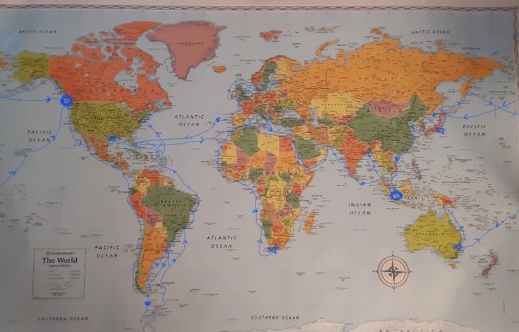
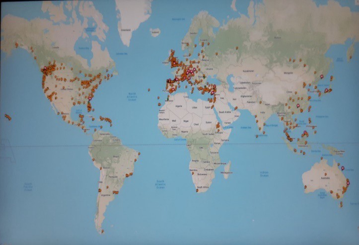
On Canadian Thanksgiving Day (October 10, 2021), the time I first started to write this manuscript, TripAdvisor informed me I had travelled 3,297,067 km, 65% of the world, and been to eighty-seven (87) countries. The last time I was out of the country was in February 2020 on my sea voyage to Paradise Bay, Antarctica. My wife and I arrived home on March 8, 2020, just before the lockdown caused by COVID-19, the scourge of humanity that had by then, started to rage through British Columbia. I once read that with the medical panic and prolonged isolation due to the Covid pandemic, a person’s mental health could deteriorate. Perhaps “Travel” whether physical or virtual help this mental condition? “Travel” to me is “Geographic Pilgrimage” – symbolic acting out of an inner journey. The inner journey is the interpolation of the meanings and signs of the outer pilgrimage. We have been advised that foolish people and children should never leave things half-done. There is much more for me to discover and learn!
The Legacy of Explorers and Settlers?
Have early explorers and settlers to foreign lands made the world a better place? We, as modern old armchair tourists and “time-travellers,” try to understand the differences and reasons for people travelling the world in the past centuries. But do we understand? Is it true that history is written by the victors-and mostly with White Judeo-Christian bias? Does “The Evil That Men Do Lives After Them; The Good is Oft Interred with their Bones”?


“We are so eager to judge people by their past. and it is not fair. We are what we are now, not an hour ago, and what we are planning, and not what we are vainly trying to forget”:- Frank Laubach (1884-1970). The past was good. “Those were the days! — those old ones. They will come no more. Youth will come no more. They were so full to the brim with the wine of life; there have been no others like them.”:-Mark Twain to a mutual friend of his and John Mackay. Even though we must be aware of the history and learn from the past, the dangers of fixing our minds on only the old evils of others (besides seeking our repentance) are undoubtedly useless. Looking at periods of human history for past sins is indeed distortive and distracting to the effort of thinking through a shared future. We all must try extremely hard not to be chewing on the cud, metaphorically so to speak, but you know what I mean. We need to continue with our journey, and look and work for a brighter future…

Conclusion:
Good stories always introduce sensational, marvellous, or magical events, but this is not. Some would not even believe nor understand the circumstances or events, particularly if the story is about supernatural events or happenings, such as my account of an “angel” protecting us on the Camino de Santiago. This comparative story of Silk Road, Five Continents and Seven Seas – through my lens is a simple addition to my other publications: Free Pilgrim, Free Pilgrim 2, Free Pilgrim 3, Memoirs of a Free Pilgrim and Thoughts During Pandemic 2020 – a journal written during lockdown and self-isolation after the arrival of COVID-19.
The following publications are available at: https://books.friesenpress.com/store/search?q=nicholas+fung https://www.amazon.co.uk/s?k=free+pilgrim, https://www.barnesandnoble.com/w/thoughts-during-pandemic-2020-nicholas-fung/1140201050?ean=9781039111561 and all online bookstores. They are also available in eBook format from these sites:
Just some thoughts
As I concluded, exciting thoughts came into my mind. What would my biography be like if someone else were to write it without the ability to see the third person in me? To do so with the freedom to judge my character and assess my accomplishments without fear of contradiction? To me, it might not be such a bad idea for us to write up our history (and story) as another biographer might just want and love to do. So, did Mark Twain say: “The two most important days in your life are the day you are born and the day you find out why?” The Scottish poet Robert Burns (1759-1796) is known for his famous line: “O wad some Pow’r the giftie gie us; To see oursels as ithers see us!” (Oh, would some Power give us the gift; To see ourselves as others see us!) – To A Louse, On Seeing One on a Lady’s Bonnet at Church …
Would we improve were God to grant us this inestimable boon?
You must be logged in to post a comment.